As J.T. Shaver, a forester with the Colorado State Forest Service, strolls through the Hutchison Ranch, a legacy cattle farm in Salida, Colorado, it’s what he doesn’t see that excites him most.
Last year, the trees here were so dense you couldn’t see more than 20 feet away. The 11,713-foot peak of Methodist Mountain was obscured by piñon-juniper trees. Now, the trunks are pleasantly spaced out, letting in beams of sunlight. The ground is scattered with wood chips and stumps, feeding a healthy new bed of grasses.
“This looks completely different than this time last year,” Shaver says. “I’m pleasantly surprised.”
The landscape’s evolution was the result of a weeks-long treatment organized by Shaver’s office to help this 5,800-person town prepare for wildfire. By thinning the dense thickets of trees, any fire that does reach the ranch shouldn’t burn hot and fast in the crown of the trees. Instead, it should run along the ground with less intensity, burning more naturally. “We’re mimicking the behavior of a wildfire that would have occurred prior to European settlement,” Shaver’s colleague, Josh Kuehn, explains.
Over the past decade, Chaffee County’s once sleepy population has steadily grown as people seek refuge from the busier Interstate 70 corridor. In 2017, county leaders convened a master planning process but were surprised to learn that residents’ No. 1 concern wasn’t small business sustainability or housing prices or even traffic. It was wildfire.
“We knew about the beetle kill epidemic and saw that our forests were in poor health,” says Kim Marquis, project and outreach coordinator for Envision Chaffee County. “The first step to growth planning was taking on our wildfire risk.”
At that point, Chaffee County had been spared from the intense fires ravaging the state in recent decades, although the 2019 Decker Fire would soon burn just two miles south of Salida. But residents had embraced the frightening reality that few places in Colorado are safe from fires. Climate change and the decades-long drought have been fueling bigger and more dangerous fires, leaving devastation up and down watersheds.
The county assembled stakeholders, including state foresters, federal officials, local landowners and farmers, to work proactively to improve forest health. Aurora Water also joined the talks, since a fire near Salida could potentially pollute the headwaters of the Arkansas River, one of Aurora’s primary water sources. The partners thoroughly mapped the area, highlighting the properties and forests most at risk if a fire did come through the Rio Grande and San Isabel National Forests.
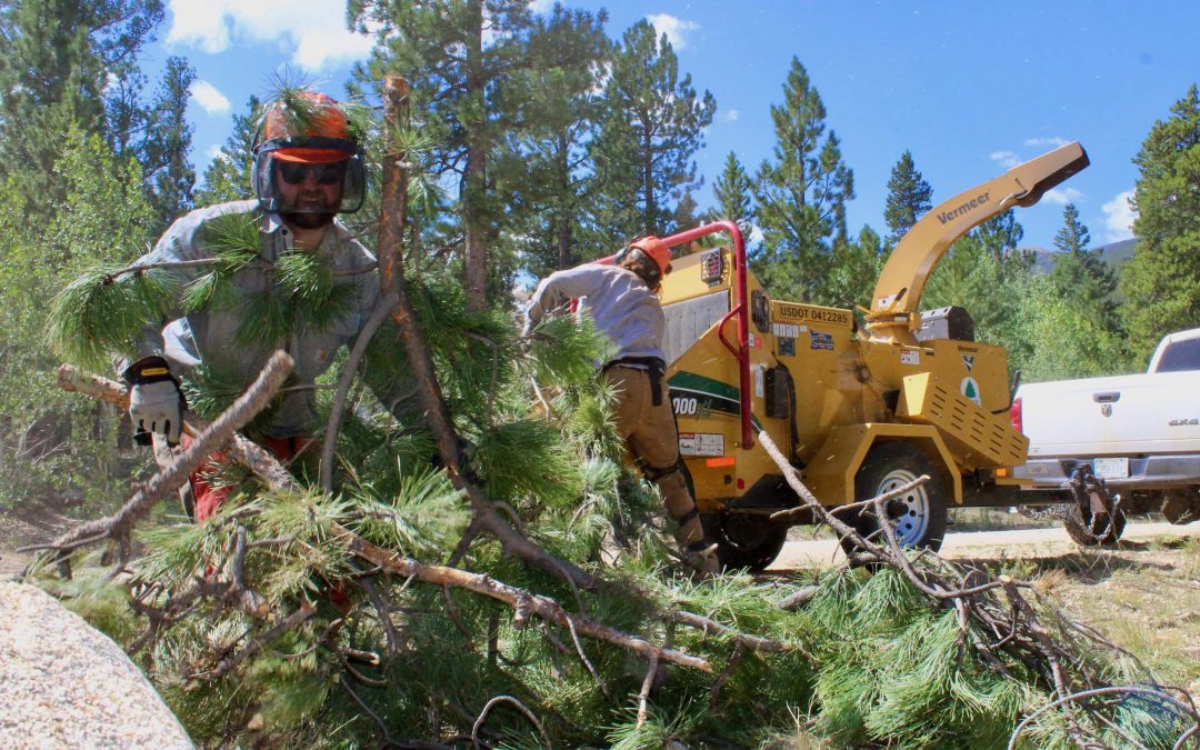
While local landowners could take their own preventative measures like shoring up buildings and removing dead trees, the Colorado State Forest Service (CSFS) also received funding for a more holistic treatment. The Methodist Front Wildland Urban Interface Forest and Watershed Health Restoration Project, funded through a RESTORE Colorado Program grant, along with the U.S. Forest Service (USFS), Salida and Poncha Springs, and a county fund, will treat 478 acres of public and private land, masticating trees to thin out the crowns and encourage healthier vegetation. Eventually, with the participation of enough landowners, the fuel break will stretch five miles, creating a buffer between the forest and the ranches, townhomes and small farms in Salida.
From the top of a hill on the Hutchinson Ranch, it’s easy to see why the treatment is essential. There are visible gaps between the trees on the ranch land, even though the trees don’t look overly manicured. Meanwhile, the untreated land just south is dense and wild, a potential path of destruction to a new condo development. In the distance, the Arkansas River that feeds Front Range communities is visible.
And to the west, just above the newly thinned forest, is a barren, charred burn scar from the 2019 Decker Fire, a chilling reminder to Shaver of how close Salida came to devastation and why it’s more essential than ever that the town prepare for the new era of fires.
How Fires Went From Healthy To Hazardous
The Decker Fire, which burned nearly 9,000 acres, came in an unusually calm year in the midst of a decade that has reshaped how Coloradans see fire. Since 2012, six megafires, defined by the National Interagency Fire Center as fires larger than 100,000 acres, have burned in Colorado. 2020 saw the state’s three largest recorded fires to date—Cameron Peak, East Troublesome and Pine Gulch—and some 700,000 acres burned, more than 540,000 of which burned in those three fires alone. And the CSFS’s 2020 Forest Action Plan projects a 50% to 200% increase in the annual area burned in the state by 2050.

During 2020’s Pine Gulch Fire, north of Grand Junction, Colo., hotshot firefighters watch and wait for the fire to burn through brush and move to grass fields, where the flames become less intense, before they can hold it back. Photo by Kyle Miller/Wyoming Hotshots, USFS, via National Interagency Fire Center
There’s no single factor making Rocky Mountain fires more intense. Bark beetle infestations swept through tens of millions of acres of forest in the West over the past two decades, leaving large stands of dead trees. A century of federal policy that squelched out all fires rather than letting them burn naturally led to a buildup of fuel stores in forests. Climate change is creating warmer and drier conditions, and an earlier snowmelt has extended the fire season.
Chuck Rhoades, a research biogeochemist at the USFS’s Rocky Mountain Research Station, says those “compound disturbances” have created a pattern of fires that are burning more intensely and in places and seasons that experts wouldn’t predict. Fires that once would have been a natural tool to clear dead fuel and encourage seeds to sprout are now a major threat to communities. Some, including Cameron Peak and East Troublesome, have ravaged high-elevation forests where fires used to be rare. A 2021 study in the Proceedings of the National Academy of Sciences found that high-elevation forests in the Rocky Mountain region are burning more than at any point in the past 2,000 years.
That, Rhoades says, means land managers and cities are seeing impacts outside the scope of anything they’ve prepared for—with ripple effects throughout the environment.
“We often think that where we were before will help us predict where we’re going,” he says. “But there are a lot of question marks out there. It forces a little humility in that we can’t understand what we’re going to get next.”
One known, however, is that the higher-intensity wildfires are putting more Coloradans at risk as the state’s population booms. In 2020, the CSFS estimated that half of the state’s population lived in Colorado’s 3.2 million-acre wildland-urban interface area, known as the WUI, where human development intermingles with fire-prone vegetation. By 2050, CSFS says that area could triple in size to encompass more than 9 million acres, or more than 13% of the state.
The risks are especially profound for watersheds. As more intense fires clear out thick older trees, shrubs and grasses grow back in their place. Without dense roots and pine needle cover, the forest floor that typically acts as a sponge for snowmelt and precipitation is turning fragile and rocky. Those are prime conditions for erosion and flooding, with streams and rivers accumulating water faster and earlier than usual. According to USFS research, the risk of flooding and debris flow is higher for at least 3-5 years post-fire, often longer, and those floods can be as much as three times more severe than they would be otherwise.
Runoff from burn scars can run black, laden with ash, debris, nutrients and heavy metals from burned soil and biomass. If those contaminants reach utilities’ water infrastructure, they can clog water filters or settle in reservoirs, possibly fostering algal blooms and taking up valuable reservoir space.
The 1996 Buffalo Creek Fire and the 2002 Hayman Fire, the largest in Colorado’s history until 2020, each burned along the Upper South Platte River, immediately upstream of Strontia Springs Reservoir, which accommodates about 80% of Denver Water’s raw water supply and 90% of Aurora’s supply. The fires exacerbated erosion in the watershed, leading to sediment-laden flows that dumped debris and contaminants in the reservoir. More than a decade later, the reservoir’s capacity to store water remains reduced, and water quality is still impacted from sediment flows, even after $27.7 million worth of dredging, removal and recovery work. Last year’s fires caused water utilities across the state to shift their operations to protect their source water.
It’s clear, then, that the risks of fires no longer stay in the forest. Partnerships have sprung up from Boulder to Durango to protect valuable watersheds and water infrastructure, forcing water district managers to become just as interested in what happens to the forest around headwaters as what goes into their customers’ pipes.
“We all share a mutual natural resource interest, whether it’s the forest or the fish of the water,” says Ken Curtis, general manager of the Dolores Water Conservancy District in Cortez. “As a water provider, we want to keep offering the same quality water we’ve had for 100 years down here. Now instead of thinking as a water protector, we’ve become part of the watershed protection.”
All Hands on Deck
In 2020, the Colorado State Forest Service released its updated Forest Action Plan, identifying some 2.5 million acres—roughly 10% of the state’s forests—as being “in urgent need of treatment.” The highest priority forests were in the Front Range’s Arapaho-Roosevelt and Pike-San Isabel forests and in the San Juan Forest around Durango. “We have to prioritize those areas where we’re going to get the most bang for the buck,” says Weston Toll, watershed program specialist for the CSFS. Still, he says, with so much of the state at risk, “we’re paddling against the current.”
The Forest Action Plan’s priority map reflected a range of factors, including where fuel had built up, how close fires could get to human development, and the impact on wildlife and water. But those areas didn’t all line up with valuable headwaters, despite some water managers’ arguments that any waterways must be protected. Nor does the map give much direction on how to square the widespread needs with limited resources.
Wildfire mitigation used to be defined by what some experts call “random acts of restoration,” individual projects on small plots of land depending on the owner’s interest and availability. A National Forest might have dead trees removed and fuel treated for insect infestation, but neighboring land might be left untreated, doing little for the overall region’s safety.
Now, the USFS and others are promoting a philosophy of shared stewardship, bringing together a variety of partners ranging from federal land managers, local water districts, utilities, logging companies, recreationists and private landowners to collaborate on responsible forest management.
Toll says the state may still be paddling against the current, but “it helps to have everyone paddling in the same direction, which wasn’t happening until five or 10 years ago.”
Take the Rocky Mountain Restoration Initiative (RMRI), a partnership co-convened by the USFS and the National Wild Turkey Federation that has brought together federal, state, local, private and nonprofit partners across Colorado for three targeted restoration projects. Tara Umphries, shared stewardship and RMRI project manager for USFS, says that leads to projects that focus on “consecutiveness,” crossing both physical boundaries and different partners’ priorities.
“Everyone brings their own expertise and their perspective to the table and has their own ideas on how to get this landscape work done,” Umphries says. “A watershed doesn’t just reside on Forest Service land and it doesn’t just provide benefits for one entity or user. To look at a discrete piece of land or a single agency for a solution, historically, has not yielded the results we need.”
RMRI was founded in 2019 as an evolution of the U.S. Department of Agriculture’s Shared Stewardship Strategy, which works across public and private lands on landscape protection. RMRI touts the four values shared by its partners: restore forests and habitat, protect communities, support recreation and tourism, and ensure clean and secure water.
In the first showcase project in Southwest Colorado, RMRI partners have done a variety of projects in and around the San Juan National Forest, including treating the forest land for dead trees, creating fuel breaks, clearing trails for recreation users, and conducting prescribed burns. At the end of 2020, RMRI partners had worked on more than 26,000 acres of forest, including high-priority areas around the Dolores River and the 381,000 acre-foot McPhee Reservoir.
“If we don’t have clean and secure water for people and our natural resources, you can’t get through much else,” says Jason Lawhon, southwest project manager for RMRI. “That’s often the place we start. Here in Southwest Colorado, water is the most important value.”
Lawhon says that bringing in those partners who can focus on the watershed impacts, whether they’re irrigators or district managers, has helped expand the scale of what the USFS could do alone through additional funding and strategy. “A lot of what we do is identify a project that’s already moving in the right direction, then we help it take the next step,” he says.
Curtis, who manages McPhee Reservoir, says the water managers’ role in Western communities makes it easy for them to act as “conveners,” bringing together federal, industrial and municipal partners. The reservoir, which provides irrigation water for 75,000 acres of land and supplies several towns and the Ute Mountain Ute Tribe, sits on the edge of the San Juan National Forest and would be at severe risk should a fire occur. Curtis says the reservoir has so far avoided serious sediment loading and flooding, and he wants to do as much as possible to keep it that way.
“Everybody out here has forest management plans and they all have implications for us as a water district,” Curtis says. While the Dolores Water Conservancy District can do tree thinning and other protection immediately around the reservoir, it takes more partners to fund and execute the work needed to keep the full headwaters area safe.
Besides RMRI, the Dolores Water Conservancy District is part of the Dolores Watershed and Resilient Forest (DWRF) Collaborative in Southwest Colorado, which includes the San Juan National Forest, five local water districts, conservationists and timber companies. The collective came out of a collaboration between Montezuma County and local timber companies to work on forest health. Organizers say the involvement of private companies is key to its success—not only does it bring their financial power to bear, but the timber industry can also use trees that are felled, providing additional financial incentive to doing the work.

Watershed Assessment Vulnerability Evaluation (WAVE) volunteers work to install silt fencing immediately above Northern Water’s Willow Creek Reservoir. Photo by Emanuel Deleon, Colorado State University
Holistic forest management also requires the help of private landowners whose property borders or includes the most at-risk forests. Blake Osborn of the Colorado Water Center at Colorado State University says there’s no “established protocol” for how to take care of private lands like there is for public areas, leaving many landowners frustrated and clueless. In 2017, Osborn started the Watershed Assessment and Vulnerability Evaluation (WAVE) to help landowners get technical assistance and craft recovery plans, leaning on the USFS’s Good Neighbor Authority, which allows state forestry agencies to partner with the USFS to tackle projects on federal land.
The key, Osborn says, is that the plans can be tailored to the specific lands and owners’ priorities, whether that be heavy tree cover for privacy or a clean waterway stocked with fish. WAVE can also help connect private partners with the bigger public partners to ensure a truly holistic approach. Although no two landowners have ever shared identical goals, he says, the takeaway message is always the same.
“Something we’re always trying to communicate is that the risks cascade down the watershed, and issues up high may not materialize until you’re down at the city level,” Osborn says. “But everyone has their priorities at every point on the watershed. With such an interconnected system, putting some money on a project up here may help protect people miles away.”
‘Mutual Benefits’
After the runoff from the Buffalo Creek and Hayman fires poured sediment into Strontia Springs Reservoir, officials at Denver Water realized they could be spending less money and having a bigger impact by focusing on preventing fires and flooding before the effects reached their infrastructure. The utility formed the From Forests to Faucets partnership with USFS, a multi-year effort to fund forest health projects to boost resilience in priority areas within Denver Water’s collection system. In 2017, the program was expanded to include state and local authorities to stretch Denver Water’s forest health work to non-federal lands.
Fuel breaks around the Dillon Reservoir watershed funded by the program are credited with protecting nearly 1,400 homes near Silverthorne during the 2018 Buffalo Fire, despite red-flag drought conditions.
“There was this exciting realization that there were a lot of mutual benefits in funding these projects,” says Madelene McDonald, watershed planner at Denver Water. “Forest restoration projects not only bolster source water protection, but also improve wildlife habitat, expand recreation access, and can protect communities in the wildland urban interface.”
Northern Water also has a forest health program, the Colorado-Big Thompson Headwaters Partnership, working with the U.S. Bureau of Reclamation, USFS, CSFS, the National Park Service, and the Western Area Power Administration to protect headwaters areas. It’s the kind of work that, two or three decades ago, might have seemed outside the scope of a water provider focused on bringing clean, safe water to its ratepayers, but has now become an accepted cost of doing business.
Even though the nature of fire has changed, the prevention strategies look similar to what foresters have done for more than a century. Clearing out dead fuel—either by cutting trees or prescribed burns—cuts off the material that would burn in a fire and keeps blazes from becoming as severe. Rather than suppressing all fire, under the right conditions, officials can manage fires in secluded locations that have started from natural means, like lightning strikes, and, during wetter years when winds are low, let them burn naturally.
Another key prevention strategy is the use of prescribed burns, where foresters deliberately set and manage a fire under specific weather and forest conditions. Considered one of the most effective mitigation strategies, prescribed burns can efficiently clear out fuel, mimicking a natural, healthy fire. However, Toll notes, those burns do come with risks, like the potential to get out of control and negative air quality impacts from added wildfire smoke.
“The risk is always going to be there no matter what, so the question is whether it’s worth taking that risk under the conditions that have a high likelihood of success,” Toll says. “[Prescribed burns] also have an educational component by showing that not all fire is bad.”
But it is also incumbent on communities to do their own preparation. That can include building codes that require fire-resistant building material or defensible space requirements to clear fuel from some established perimeter around buildings. Colorado does not have a state wildfire code or model ordinance, despite recommendations from a 2014 task force, but communities like Boulder and Colorado Springs have regulations governing new homes in at-risk areas.
Counties have developed their own mitigation and evacuation plans for areas in the WUI. Others are adapting their own emergency plans to account for the widespread effects of fires, including the greater risks of mudslides and sediment deposits. Chaffee County, for example, updated its wildfire community plan to account for community expansion into the WUI and the greater threat of fires to produce a document that didn’t just guide county-level mitigation work, but also individual landowners’ preparations.
“There’s a big educational component, but seeing a disaster happening right in our faces prepares people,” says Marquis of Envision Chaffee County. “We’re asking people to join this honestly heroic story to protect the community.”
Money Matters
Addressing all of the CSFS’ Forest Action Plan’s priority areas is estimated to cost $4.2 billion, money that state agencies and local partnerships just don’t have. USFS spent $1.8 billion in fire suppression, fighting and responding to wildfires nationally in fiscal year 2020, but just $431 million on treatments to reduce fuel buildup through its Hazardous Fuels program, according to national spokesperson Babete Anderson. According to National Interagency Fire Center data, other federal government programs spent $510 million on fire suppression in 2020. According to a Colorado Department of Public Safety report, Colorado’s 2020 fire season cost the state an estimated $38 million in suppression costs and required another $248 million in federal funds. Those state figures don’t include suppression costs footed by local agencies or the costs of property loss, infrastructure damage, watershed impacts, or economic losses. Nor do they account for other private, local, county or federal wildfire expenses.

Andy McCoy, owner of Cascade Timber Salvage, talks with a timber sale administrator with the San Juan National Forest in Southwest Colorado. The timber industry can help thin forests and clear trees, putting them to use and selling them, while reducing the risk of intense fire. Photo by Jerry McBride/Durango Herald
As of press time, Congress was still negotiating the bipartisan infrastructure bill and reconciliation bill. If passed, the nearly $1 trillion infrastructure bill includes about $8 billion for wildfire risk reduction and forest restoration, including $90 million a year for the U.S. Department of Agriculture’s Landscape Restoration Partnership Initiative to support forest and grassland restoration secured by Colorado Sen. Michael Bennet. The bill also spends $600 million to raise federal firefighter wages.
Fire departments and forest managers can also cobble together money from grants from a variety of federal sources. In 2021, the Colorado legislature passed SB21-258, which authorized $25 million for wildfire mitigation, recovery and workforce development. In a statement, Colorado Department of Natural Resources director Dan Gibbs said the bill would “quickly move resources to on-the-ground projects and mitigation teams,” a step up from previous efforts that “have lacked the coordination, landscape-scale focus and robust state investment required to properly address the size and behavior of catastrophic wildfires.”
Even with those funding sources, it can be a challenge to prioritize spending in areas with the biggest benefit, or even address the widespread impacts of fires. Studies have shown that up-front mitigation saves costs on fire suppression, but even that is daunting when the needs are so vast.
“There’s just a disconnect between what we spend money on and the protection of watersheds and communities,” says Carol Ekarius of Coalitions & Collaboratives (COCO), a group that has been leading the way to foster collaborative conservation and restoration in Colorado headwaters and nationally. Ekarius’ work began more than two decades ago, as coordinator for the Coalition for the Upper South Platte (CUSP), after the 1996 Buffalo Creek Fire. When other regions also experienced burns in the 2000s, they reached out to CUSP for advice—COCO formed to mentor those organizations. “A fire could burn on federal land but the post-fire impacts are on the downstream communities,” says Ekarius.
Combining efforts through partnerships like RMRI can make every mitigation dollar go further, as can matching grant programs from the state and federal government. Summit County voters in 2018 passed a $1 million annual fund for wildfire mitigation backed by a mill levy rate adjustment. The timber industry has played an increasing role, with the state offering loans to encourage loggers to produce wood products—everything from lumber to pellet fuel—from forests that need thinning or dead trees that can be cleaned up and put to use.
In a 2019 issue paper, the International Association of Wildland Fire said that it is important to “frame a narrative” around fire that “looks to longer-term landscape outcomes.” That argument, the group wrote, “will eventually have to be won based on economics, as the suppression and recovery costs will by far exceed costs required to educate communities, undertake mitigation works and improve land use planning controls.”
Shaver, the Salida forester, says his community seems to understand that narrative and is on board with the cost of mitigation, knowing that the worst risk could be coming during any upcoming fire season.
“Sometimes there’s a feeling that you wish a fire would come through to validate the work,” Shaver says. “But a lot of people say they feel safer, and that in and of itself makes the work successful. Feeling safe is a win whether or not anything ever burns.”
Jason Plautz is a journalist based in Denver specializing in environmental policy. His writing has appeared in High Country News, Reveal, HuffPost, National Journal, and Undark, among other outlets.
 Print
Print