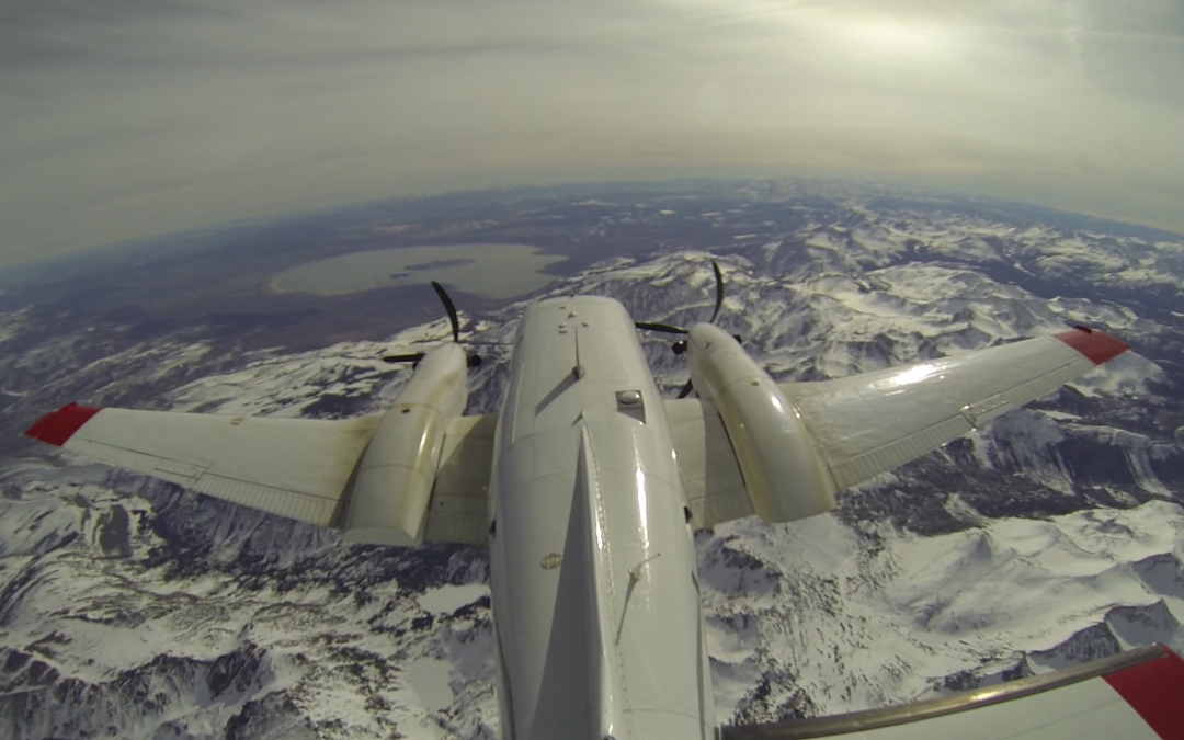
A high-flying, NASA-backed measuring system capable of dramatically improving water forecasts may roll out across the Upper Colorado River Basin if states on the lower end of the river come forward with funding.
Traditional ground-based water forecasting systems have widely varying accuracy rates, due to the difficulty of predicting future weather and rates of snow melt. Forecasts can be off by as much as 40 percent. But the new NASA system has reduced those error rates to roughly 2 percent, according to recent reports.
Such a system could allow water managers across the drought-stressed seven-state Colorado River Basin to better manage the mountain snows on which they rely for water.
The Airborne Snow Observatory, or ASO as the new system is known, has been operating in California’s Sierra Nevada mountains since 2013 helping water managers there hone forecasts.
Developed by a team led by Thomas Painter at NASA’s Jet Propulsion Lab in Pasadena, Calif., the ASO has been operating on a limited basis in Colorado since 2015.
Expanding its reach
This year, water agencies in Nevada, Arizona and California have expressed an interest in helping fund a program that would cover the four states of the Upper Colorado River Basin – Utah, Wyoming, and New Mexico as well as Colorado, according to Joe Busto, a scientist and researcher at the Colorado Water Conservation Board who oversees the ASO program here. Officials in those lower basin states could not be reached for comment.
How quickly that could occur isn’t clear. Busto is sending those states data later this year when the latest results of this year’s flyovers are in.
“There is no better way to measure the snowpack,” Busto said. “When you have seven SNOTEL’s (ground-based snow measuring sites) in a watershed and Tom [Painter] can collect 3,000 data points in a second, it’s a much more robust way to assess the snow.”
Quest for accuracy
Since the early 1930s, snow packs have been measured by hand and via remote ground sensing by the federal Natural Resources Conservation Service, but forecasts can change dramatically if the weather becomes volatile, as it has been doing more often in recent years.

A NCRS snotel site near Redstone, Colorado. Credit: Water Education Colorado
That volatility and the ongoing drought have made water forecasting even more critical for water agencies that rely on the Colorado River.
Denver Water, Colorado’s largest municipal water utility, is one of those agencies. It delivers some 300,000 acre-feet of water to its customers annually. An acre-foot is enough to serve two urban households. Even a 10 percent miss would mean some 30,000 acre-feet of water – enough for 60,000 homes — is either missing or flowing downstream.
Nathan Elder, raw water supply manager for Denver Water, said his agency is watching the ASO program closely. “The level of accuracy they have seen has definitely gotten our attention,” he said.
Denver Water already uses a wide range of supply scenarios each year to ensure it can cover any events that may arise. “But if we had a more accurate forecast it would make my job easier,” Elder said. “It would allow us to look at other benefits with things like rafting flows and flows for fish. It would help downstream users have a better idea of what flows are coming. It would really allow us to plan for those types of things, rather than hope for them.”
To achieve these dramatic improvements in accuracy, the ASO uses a special plane equipped with sensors that map terrain and measure the depth of the snow and its reflectivity. That combination of information allows forecasters to better determine how much actual water is in the snow.
On the ground
Brian Domonkos is the snow survey supervisor for the Natural Resource Conservation Service (NRCS) in Lakewood. His small band of staffers, five including him, is responsible for monitoring and maintaining 156 SNOTEL sites across Colorado, New Mexico, Utah and southern Wyoming. They travel thousands of miles every year gathering data and maintaining the sites.
“It’s a lot of work,” Domonkos said. Any new technology that could build on his ground-based work and help improve water forecasting would be helpful, he said.
Cara McCarthy, an NRCS forecaster based in Portland, Ore., said the geographical expanse of ASO’s data is game-changing. Her agency’s SNOTEL surveys give critical on-the-ground readings, “and these are pretty darned accurate,” she said. “The difference is they are a single point. What you get with the NASA flyovers is a lot more information.”
The ASO is a young technology. Still, it has generated intense interest in the water world.
“Through the years the holy grail of remote sensing and snow hydrology was knowing just how much water is tied up in the snowpack and where it was distributed,” Painter said.
Bringing precision to that equation has huge implications in the West, as the region struggles to keep its reservoirs above crisis levels and the weather becomes even more variable.
“It has big impacts on people’s lives,” Painter said.
Building a grid
ASO works by flying over thousands of acres of terrain using LiDAR, a pulsing radar, to develop a grid that contains a deeply detailed picture of the ground when it isn’t covered by snow. Then, during the winter months, it flies the same terrain once or more each month when it is covered with snow. In this way, it is able to measure snow depth and snow reflectivity. These data, combined with computer-based models, allow the ASO to generate precise readings on when the snow will actually melt and how much water each snowpack actually contains.

NASA researchers in Colorado San Juans. Credit: NASA
The five years in which Painter has been collecting data on his flights in California include the worst snowpack years on record in 2015, an average year in 2016, and one of the best snowpack years ever in California in 2017. “We have proof of accuracy across this whole range of water-year types,” Painter said.
As with many new technologies the ASO is expensive. One flight hour costs $1,500 and the specially equipped plane comes with a $2.5 million price tag, Painter said.
“It’s not a particularly cheap solution,” he said. “It’s not like a camera on your cellphone, but the returns are going to be 100 to one when you combine the costs of water purchases, hydropower generation, recreational utilization and operational flexibility.”
Colorado has already spent $800,000 collecting and testing Painter’s data, according to the CWCB’s Busto, and the state will continue to spend roughly $300,000 annually on the technology.
Since 2015, when the Colorado pilot began, Painter has flown the Upper Gunnison River Basin and the Grand Mesa. Running an ASO program across the four state region would likely cost $12 million to $15 million annually, Painter said.
NASA’s funding for ASO operations in California ended in 2017 and has been taken over by the California Department of Water Resources and others, Painter said.
But the space agency’s research on new water management tools isn’t ending. Painter said he is working on a satellite version of the ASO which would measure snowpacks from space. “But we’re not likely to see satellites supplant the aerial version for regional [snowpack] management because the planes and instruments are much cheaper. A satellite could cost several hundred million dollars, even up to $1 billion, and if it breaks you can’t land them, fix them, and send them back up.”
Jerd Smith is editor of Fresh Water News. She can be reached at 720-398-6474, via email at jerd@wateredco.org or @jerd_smith. Fresh Water News is an independent, non-partisan news initiative of Water Education Colorado. Our editorial policy can be viewed here.


 Print
Print